Great North Trail Part 8: John o' Groats
Great North Trail Part 8: John o' Groats
Oykel Bridge to John o' Groats
Part 8 of Cycling UK's Great North Trail, an off-road route from the Peak District to Cape Wrath or John o' Groats.
See places to stay, eat and visit in the full route guide
Best for
Exploring quiet, remote glens, lochs and the rugged north coastline.
Area and route
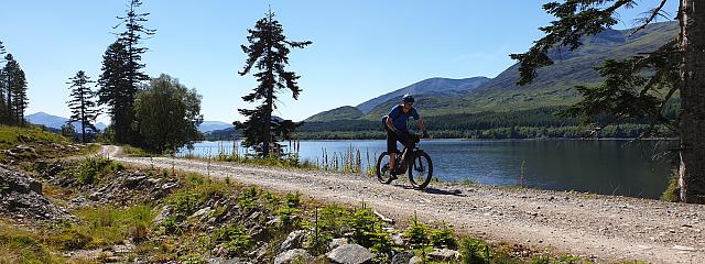
In this final section of the Great North Trail, the route is still very remote and wild, although there are some easier and flatter sections, plus good trails.
You’ll explore long and remote glens, pass hydro power stations, far flung lodges and shimmering lochs. With this raw beauty and freedom, though, come few and far between facilities, and little shelter from rain and wind. So, be well-prepared for hostile conditions, book and plan ahead.
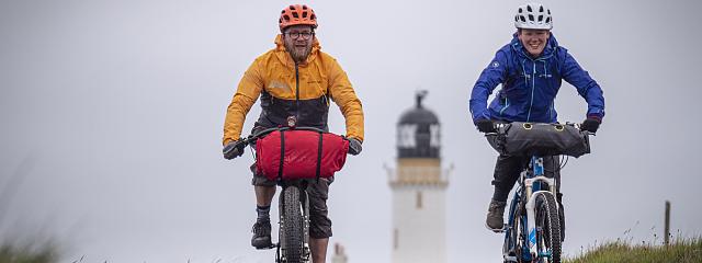
This journey also lets you choose the ending to your story: will it be John o’ Groats, the most north-easterly port of mainland Scotland, or Cape Wrath, the quiet, remote and most north-westerly point?
Cape Wrath is a spectacular end point and offers more off-road riding in comparison to the John o’ Groats route, which relies more on remote singletrack roads.
Note, however, that rough seas might cancel the small ferry over to the Cape Wrath peninsula, while the MoD may close off the land to the general public. If you make it to the lighthouse, though, views of the wild sea, a café and a wonderful remote bothy on the beach await you. You will also be eligible to join the Cape Wrath Fellowship.
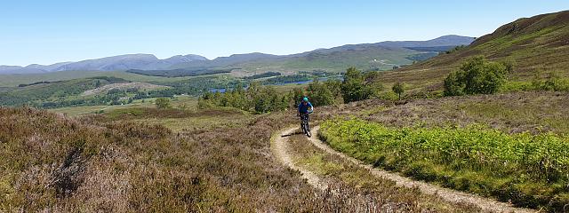
The journey to John o’ Groats may be further, but with mostly quite singletrack roads and good tracks across this now much flatter land, and with the end in sight, it will fly by.
For one last adventure into the wild hills and the reward of a superb descent and a little less tarmac, opt for a tougher loop via Loch Choire.
As a destination, John o’ Groats is hugely popular - but for a more personal, wild and natural finish line, make the short detour to the magical Duncansby Head.
Sit down on the cliff tops, gaze out to sea and reflect on the amazing journey that has brought you here.

Useful info
Scotland is an off-road cyclists haven. Not only has the Land Reform (Scotland) Act 2003 given riders the same rights of access rights as walkers, but also the 18th century military roads and hydro-electric schemes have created hundreds of miles of good tracks across the hills and mountains, enabling cyclists to travel all over the Scottish Highlands, largely avoiding roads.
Access Code – while the Land Reform Act gives mountain bikers the same rights of access to the outdoors as walkers, it also makes users responsible for knowing and abiding by the 'Access Code'. See ‘Do the Ride Thing' www.dmbins.com/riders/do-the-ride-thing
Mobile phone coverage is intermittent in the Highlands, so an EPIRB (emergency position-indicating radio beacon) is recommended, especially if riding solo.
Deer stalking – the (red deer) season runs from the start of July to mid-February, so you should check www.deer-management.co.uk for information on dates and whereabouts of shoots.
Wild camping is allowed in most places within Scotland, but due to the popularity of the Trossachs and Loch Lomond National Park, there are now ‘camping management zones’ in force, restricting the act of wild camping in certain areas.
Bothies are traditional, roofed shelters in the mountains, many gifted to the charity ‘The Mountain Bothy Association’ (MBA), who maintain and protect them. Most bothies are open and free to use, but don’t expect any facilities, follow the rules and be aware that they are becoming more popular and could be full when you arrive.
Navigation
Navigation is relatively simple, passing along quiet glens, with only a few limited route choices to make. It is, however, imperative that you make the right choice, as the remote location and lack of mobile reception could potentially be very dangerous.
Difficulty rating
The following ratings use the colour-coded mountain bike trail grading system - see here for an explanation. We have added a Purple grade which refers to Red technical difficulty plus remoteness, where experience of the outdoors is required. They are intended as a guide only, to help you decide which sections are best for you:
Technically speaking, the riding is not very challenging, but it is increasingly more remote, with long stretches between civilisation.
Purple: West Merkland to Gobernuisgach Lodge
Blue: Gobernuisgach Lodge to Forsinard trails
Red/Purple: Loch Choire option (from the Crask Inn to Badanloch Lodge)
Purple: Forsinard trails to Loch More (road)
Blue: Loch More to John o’ Groats