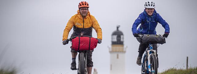
Great North Trail Part 7: Northern Highlands
Great North Trail Part 7: Northern Highlands
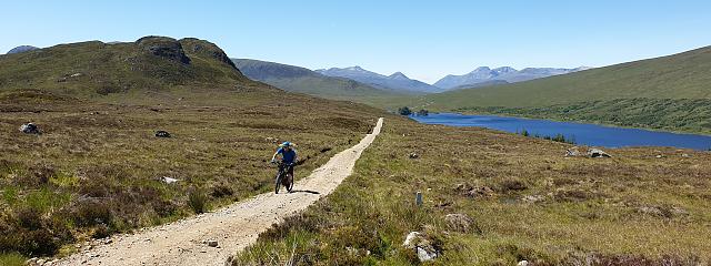
Fort Augustus to Oykel Bridge
Part 7 of Cycling UK's Great North Trail, an off-road route from the Peak District to Cape Wrath or John o' Groats.
Important trail updates
2 November 2020 - following periods of wet weather, there are several river crossings which can be difficult and potentially risky when the water is in full flow. In these circumstances you might prefer to plan a detour along the road rather than having to backtrack. Crossing grid references: NH 43999 45380 (road detour via Eskadale and Ardnagrask), NH 41528 95411 and NH 37381 97583 (road detour via Culrain).
6 October 2020 - the dam at Orrin Reservoir between Struy and Contin is currently closed for public access. SSE Renewables say this is only while refurbishment work is taking place, so it is possible to cross the dam between 14:00 on Fridays to 19:30 on Mondays. Otherwise, you can take this detour to avoid the dam.
Check the An Turas Mor website for additional updates for sections between Glasgow and Cape Wrath.
GPX file updated 28 July 2020 with a slight change to the route near Garve - please make sure you have the most current version.
See places to stay, eat and visit in the full route guide
Best for
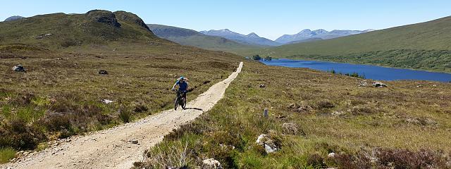
Rides exploring the most remote and wild tracks of the Scottish Highlands.
Area and route
This section of the Great North Trail follows the ‘An Turas Mor’ route (Scottish Gaelic for ‘the long journey’), developed by Obscura Mondo Cycle Club.
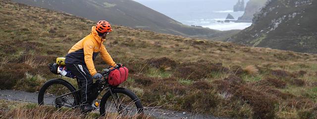
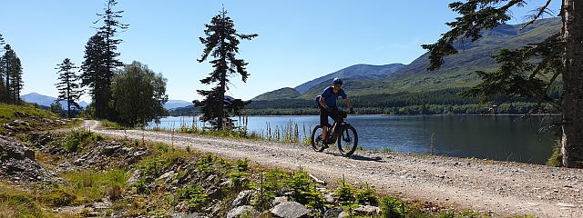
This is the most wild and remote part of the whole Great North Trail, with long stretches of old military roads and hydro scheme tracks penetrating the epic mountainous terrain of the Scottish Highlands.
You’ll need to be well-prepared and fit for this wilderness. Facilities and escape-routes are limited, but it’ll be an amazing, immersive and rewarding experience.
Fort Augustus sits on the Great Glen Fault, which separates the rocky north-west highlands from the Grampian Mountains with a series of lochs, connected by rivers. The mountains and moorland to the north of here are home to many superb, quiet glens, remote lochs and abundant red deer.
You’ll also find sad echoes of ‘The Clearances’, which forced crofters out of their homes to make way for sheep at the end of the 18th century.
The route passes through remnants of the Caledonian Forest, which once covered most of Scotland.
Before you finish up at Oykel Bridge, though, you’ll have cycled through part of the 23,000 acre Alladale Estate where a regeneration project has planted hundreds of thousands of trees and restored dried out peat bogs.

Useful info
Scotland is an off-road cyclists haven. Not only has the Land Reform (Scotland) Act 2003 given riders the same rights of access rights as walkers, but also the 18th century military roads and hydro-electric schemes have created hundreds of miles of good tracks across the hills and mountains, enabling cyclists to travel all over the Scottish Highlands, largely avoiding roads.
Access Code – while the Land Reform Act gives mountain bikers the same rights of access to the outdoors as walkers, it also makes users responsible for knowing and abiding by the 'Access Code'. See ‘Do the Ride Thing' www.dmbins.com/riders/do-the-ride-thing
Mobile phone coverage is intermittent in the Highlands, so an EPIRB (emergency position-indicating radio beacon) is recommended, especially if riding solo.
Deer stalking – the (red deer) season runs from the start of July to mid-February, so you should check www.deer-management.co.uk for information on dates and whereabouts of shoots.
Wild camping is allowed in most places within Scotland, but due to the popularity of the Trossachs and Loch Lomond National Park, there are now ‘camping management zones’ in force, restricting the act of wild camping in certain areas.
Bothies are traditional, roofed shelters in the mountains, many gifted to the charity ‘The Mountain Bothy Association’ (MBA), who maintain and protect them. Most bothies are open and free to use, but don’t expect any facilities, follow the rules and be aware that they are becoming more popular and could be full when you arrive.
Navigation
Navigation is relatively simple through the long glens, with few route choices on offer, but it is imperative that you make the right choice - the remote location and lack of mobile reception could potentially be very dangerous.
Difficulty rating
The following ratings use the colour-coded mountain bike trail grading system - see here for an explanation. We have added a Purple grade which refers to Red technical difficulty plus remoteness, where experience of the outdoors is required. They are intended as a guide only, to help you decide which sections are best for you:
Purple: Fort Augustus to Contin
Red: some optional MTB trails at Contin
Blue: Contin to Inchbae
Purple: Inchbae to Oykel Bridge