Traws Eryri: map and GPX file
Traws Eryri: map and GPX file
Explore the enthralling history, wild mystery and stunning mountain landscapes of Eryri on this challenging 200km adventure across North Wales, created by Cycling UK in partnership with Natural Resources Wales.
The Traws Eryri trail starts in the historic mid-Wales town of Machynlleth. From here it enchants, fascinates and challenges you across Eryri National Park to the medieval castle stronghold of Conwy. Our expertly curated route links wild forests, incredible mountain scenery and fascinating history using ancient tracks, Roman roads and deserted lanes through the lush valleys and rugged peaks of this truly epic landscape.
The route can be broken down into three or four day splits and also combined with the Trans Cambrian route from Knighton to Machynlleth for a full week of Welsh adventure. If you don’t have time to do the full route in one go you can also break the route into sections using the rail stations at Machynlleth, Barmouth, Betws-y-Coed and Conwy. We’ve also suggested potential itineraries in the back of the guidebook with cumulative distances to key points and locations of useful facilities.
And if you’re wondering how Traws Eryri is pronounced: ‘Traws’ rhymes with ‘mouse’; Eryri is ‘eh-ruh-ree’.
Download the route guide
For the full route guide with more detailed maps, visit the Cycling UK online shop.
Terrain
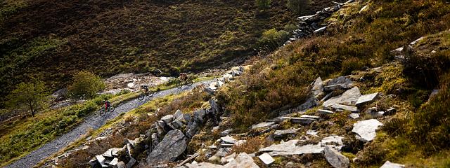
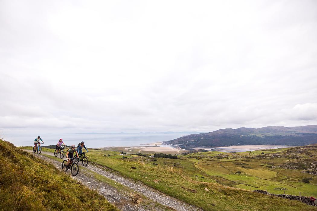
Traws Eryri is shorter than most of Cycling UK’s other multi-day routes in terms of distance, but don’t underestimate it. The sheer amount of extended, steep climbing and exhilarating off-road descending makes this route a properly challenging adventure. It will take you on a wonderful wilderness experience into remote, rarely visited areas, which is well worth the extra effort. The linear nature of the route adds an extra level of commitment, but the wiggly shape means there are shortcut options at most stages of the route if taking in the sights and scenery slows you down more than expected. We’d recommend including the wiggles if you can though: if the route appears to take a detour, there’s usually an enjoyable reason for it. Most of the trails we use have a stony base, so you won’t get bogged down whatever the weather. Some sections are quite rough and rocky, which adds a level of technical difficulty to a few of the descents, particularly in wet conditions. Make sure you have a bike and gear that you feel confident with, and there is always the option to get off and push if you don’t feel comfortable. Due to the steep gradients and high proportion of off-road riding, this route is best suited to experienced riders.
Bike and kit
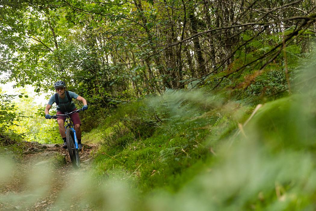
The route has been designed with mountain bikes in mind, and the steep gradients and loose rock surfaces will certainly be enjoyed most with low gears and big tyres. Using a mountain bike also opens up the chance to take in some of the purpose-built mountain bike trails at Dyfi Forest, Coed y Brenin, Penmachno and Gwydir Forest. For those who like a challenge, it could also be tackled on a gravel bike with low gearing and wide tyres if you don’t mind some pushing up and walking down in places. It's not recommended for road, touring or hybrid bikes with limited gearing and/or narrow tyres. An electric bike will make the climbs easier, but plan ahead for recharging points as Eryri will drain your battery faster than most landscapes.
There are several bike shops en route, but make sure your bike is in good order before you set off for Machynlleth. Try out anything new – including bags and clothing – in advance so you know everything works. Take tools and spares to deal with any likely on-trail issues, and pack a first aid kit too, as you will be remote from assistance at some points and phone coverage is very variable. If the weather is likely to be wet, a bottle of chain lubricant and spare brake pads are a wise precaution too.
Obviously how minimally or luxuriously you want to pack depends on you, your schedule and where you’ll be sleeping. There are several shops along the route for restocking, and specialist outdoor shops in Machynlleth, Dolgellau, Betws-y-Coed and Capel Curig. The off-road nature of the riding favours strap-on bikepacking bags and/or a backpack rather than racks and panniers that can rattle loose.
Finally, while most of the route is very remote, some sections of path – particularly the shared-use trail alongside the Mawddach estuary – can be busy, so a bell can go a long way to ensuring polite progress. They seem to work well with sheep too, which will be a more frequent issue.
Navigation
The Traws Eryri route itself isn’t waymarked, and while in places it follows routes on the National Cycle Network or others such as the Llwybr Llechi Eryri (Snowdonia Slate Trail), it's generally only for short sections and often detours off them. The easiest way to navigate is by loading the GPX file for the route onto a reliable GPS computer or smartphone that you can see as you ride. Don’t rely on live position updates on a mapping app though, as signal is patchy. Always back up electronic navigation with a ‘real’ map in case you have a battery issue. While the navigation is mostly straightforward, there are several points where the route diverts from the obvious path. We’ve listed these in the guidebook but we’d always advise checking where each section goes before riding it and keeping your head up to enjoy the views and spot turns rather than charging along with your head down.
Safety
Eryri is a true mountain landscape, and locals will always tell you to be prepared for several seasons in a day. There are large sections of the route with no shelter from whatever is coming at you out of the sky, so things can quickly become serious if bad weather is combined with an enforced stop for a mechanical issue. A spare thermal layer, a good waterproof and an emergency survival bag should be considered a minimum even in summer. All that climbing means you’ll be burning through calories quickly, too, so take more food and eat regularly to keep your energy and concentration levels up. You’ll always be safer riding in a group, but whether you’re in a bunch or going solo, using a ‘beacon’ device or app so someone else is aware of your location and schedule can be a potential lifesaver.
In terms of the route, we've tried to keep main road crossings and busy road sections to a minimum. You may sometimes have to share narrow lanes and forest roads with farm, forestry or quarry traffic so be prepared to pull over and give them plenty of room. Whether it's sheep diving into your path, rocky sections or loose gravel, off-road riding can always throw up surprises, so stay within the limits of your skill and equipment at all times.
Finally, but very importantly, always be aware of the safety and concerns of others. The route crosses many areas with grazing livestock, so make sure you keep gates shut and slow down or stop if needed rather than spooking sheep. Always slow down, say hello and give way to other trail users, farmers or forestry workers. Trails through forestry will sometimes need to be closed or diverted for maintenance work or forest operations, so make sure you follow any instructions on signs. Follow the Countryside Code, pick up any litter you find en route and generally be the best ambassador for cycling that you can. That way riders like us will be seen as a positive boost to the area, which will help to ensure Cycling UK can continue to develop more routes in wonderful places for you to enjoy.
Top tips for a great ride
- Ride responsibly: Show respect for all other users and take care of the environment.
- Leave a positive trace: Practise low-impact cycling. Follow existing paths, ride through puddles rather than widening tracks, avoid muddy trails where possible and avoid skidding. Never leave litter and go one better by picking up any rubbish you see on the trail.
- Control your bike: Stay focused, check your speed and think about other people.
- Avoid disturbing animals: Livestock, pets and wild animals can all be startled by sudden noise. Always be considerate, give them a wide berth and leave gates as you find them.
- Plan ahead: Know your bike, your equipment and your ability, and be aware of the terrain you’re riding on. Be prepared for severe weather and potential mechanical issues.
- Always give way: Let people know you’re coming with a bell, whistle or cheery ‘bore da!’ (good morning). Pass wide and slow, particularly with horse riders. Approach blind corners and descents carefully. Be Nice, Say Hi!
- Take it easy and enjoy the journey: chasing Strava segments or fastest known times can cause accidents and create negative perceptions of cycling, which makes it harder to campaign for more off-road access in the future.