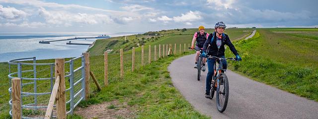
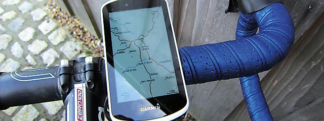
Many cyclists have seen their riding enhanced by a bar-mounted navigational computer. Combined with digital mapping, these GPS devices facilitate the planning of rides without paper maps and simplify the task of navigating along the route.
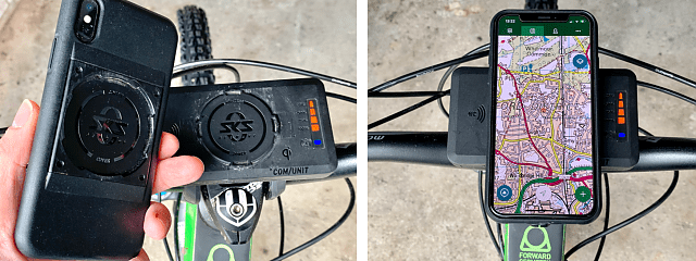
A modern smartphone comes with a GPS receiver built in, a larger screen, and more computing power than a bike-specific GPS. A myriad of apps can be downloaded to aid with route planning and navigation, and a phone often has more storage for mapping and other information. Assuming you already have a smartphone, it’s a much cheaper option than a dedicated GPS cycling computer.
When used on a bike, consider the phone’s mounting and weatherproofing. Phones are more fragile than GPS computers: you’ll need a robust case (which is rainproof if your phone isn’t), along with a phone-specific mount.
When used for anything other than navigation a phone will consume power quickly; you may need to turn off mobile data and other background tasks to conserve power.
1 Outdooractive
iOS/Android/web
£26.99/yr; £53.99/yr all features; free basic option
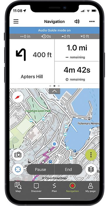
Outdooractive supersedes the discontinued Viewranger. Routes can be planned on a variety of base maps, including OS and Harvey. The planner is easy to use, and being able to flip between map types is a bonus.
It’s feature-rich, including a ‘skyline viewer’ for augmented reality and the ability to add photos to your ride while you navigate. It supports the planning and sharing of a group ride. So far, though, the content appears to be geared more towards Europe and the USA than the UK.
Verdict: Some interesting features but lacks UK-specific content
2 Komoot
iOS/Android/web
£3.99-£8.99 one UK region; £29.99 worldwide; £59.99/yr for premium features
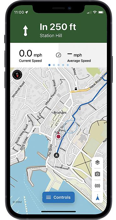
Komoot is designed for those looking to discover routes from its database or to plan their own. The curated routes include lots of detail, such as photos, road surface types and technical difficulty.
Route planning is easy: a start and destination are set and then Komoot calculates the route – which can then be modified. Navigation is also easy, with spoken instructions if desired and the ability for others to track you if you wish.
Komoot uses custom Openstreetmap mapping. Plus if you are a memebr of Cycling UK and sign up as a new user on Komoot, you can also claim a free region bundle using your member benefits.
Verdict: An excellent app for discovering and planning new routes
3 Ride with GPS
iOS/Android/web
£39.99/yr basic; £79.99/yr premium; free basic option (no offline maps)
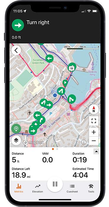
This app is designed just for cycling and comes with a database of routes created and rated by users. It’s simple to plan a route, with the ability to add waymarks, distance markers and cues. The app irons out any deviations you might accidentally plot and tells you the road surface type.
The interface is excellent, allowing custom data fields and route modifications while riding. Live logging allows you to share your location. It uses Openstreetmap mapping.
Verdict: A solid app with features akin to a dedicated GPS computer
4 OS Maps app
iOS/Android/web
£2.99 per month; £23.99/yr
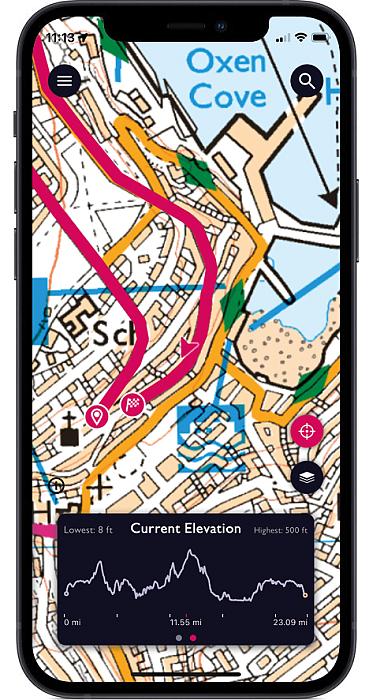
The OS Maps app gives access to up-to-date OS mapping, including the National Cycle Network. Finding routes in an area can be frustrating as summaries are hard to get to.
Route planning is easy. You can plot tracks without any automatic routing or switch on the ‘snap’ function to route you along roads/paths.
The navigational interface is basic: you follow the line on the map. There are no cues and minimal statistics. An augmented reality mode helps you identify landmarks.
Verdict: Great route planner for OS map fans but few cycling features
Overall verdict
All four apps enable you to plan, navigate and share cycling routes. Most come with a free option or trial period, which is worth trying out first to decide which works best for you.
The OS Maps app is the least functional but good value if you’re wedded to OS maps. Outdooractive is worthy of consideration, with its OS mapping layer and several innovative features. However, it’s expensive and lags behind the others on UK routes.
Komoot and Ride with GPS are both excellent apps with a vast array of routes to be discovered and explored. They are fairly intuitive to use and come with good community support. Komoot is better geared to the touring cyclist looking to find new routes and experiences, and has the best-value lifetime subscription.
Top tip
Battery backup?
Pack a small power bank for long rides. Or read Rob Kingston’s review of the Compit+ smartphone holder, a phone mount that’s also a power bank.
Member of Cycling UK? Don't forget to claim your 20% discount on an annual 12 month OS Maps premium subscription for access to maps for the whole of Great Britain for less when you use your member benefit.