Thundersnow is a little-known but very real meteorological phenomenon. The dark sky, ripped by electricity, suddenly booms out, but when that same sky opens moments later what falls upon you is not torrential rain, but blinding curtains of snow.
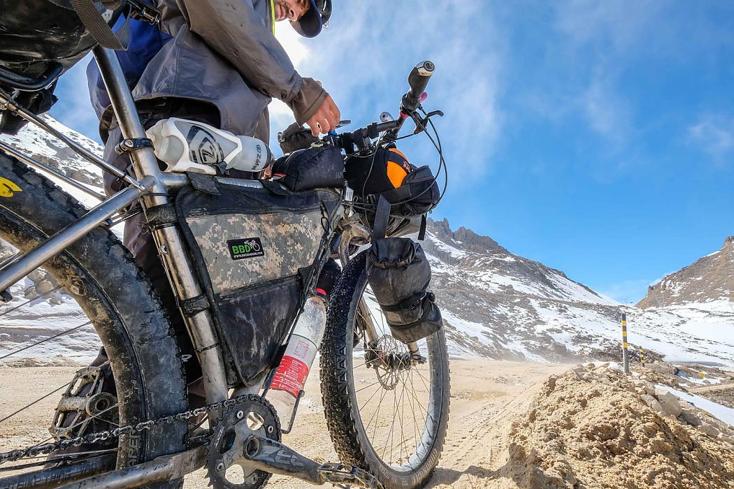
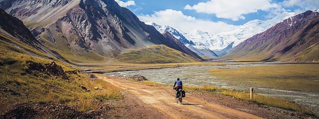
Up at 4400 metres descending on rough dirt road from the Cho La pass in the far west of China’s Sichuan Province, my rear tyre suddenly feels spongy. The sidewall on my tubeless setup had spontaneously failed in a two-inch section the day before, and unwilling to brook a delay in undertaking a route I’d been planning for months, I’d simply sewed a tyre boot around the hole, stuck a tube in it, said a prayer, and set off again. Now it seems those chickens are coming home to roost. There is no shelter here on the mountain and the snow is very wet and heavy and the wind is howling and the road is turning into a river of mud and I can’t feel my fingers.
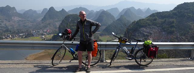
Welcome to Tibet, Tibet, it must be mentioned, is much more than just the Tibet you know. The Tibet Autonomous Region (TAR), home to the city of Lhasa and featuring heavy travel restrictions imposed upon visitors by the Chinese government, is but one of three major regions of what is culturally, historically and geographically Tibet. The ancient region of Kham, twice the size of Sweden and extending across the southeastern Tibetan Plateau, is not only home to 35% of China’s Tibetan population, but – existing largely in Yunnan, Sichuan and Qinghai provinces – is generally free of the travel restrictions that keep the TAR hidden behind a bureaucratic curtain. I’ve been cycling through the region for weeks and still have to pinch myself at police checkpoints when no one stops me to tell me I’m not allowed here.
Meanwhile in the whiteout I find the puncture in the tube, stick an instant patch to it, pump the tyre back up and set off down the road through the storm, hoping against hope…
The eastern Tibetan Plateau
One week earlier: the town of Litang on the eastern Tibetan Plateau.
Set amongst brown hills at 4100 metres and feeling like the ends of the Earth, Litang has produced not one but two Dalai Lamas. Dust swirls in the streets and nomads with long wild hair and greasy sheepskin jackets and gold-toothed grins pilot motorcycles through the town at speed like some kind of high-altitude Mad Max.
It’s the first classically Tibetan city I’ve seen in Kham, a land traditionally known for its geographic diversity as chushi gangdruk: ‘four rivers, six ranges’. All around is high-altitude grassland, but go a few hundred kilometres in any direction and you could just as easily find yourself in dense conifer forest, a lush river valley, or on a snowcapped 7000m peak.
Kham’s inhabitants, the Khampas, are known as Tibet’s fiercest warriors, having fought against not only Tibetan rulers in Lhasa to the west and various Chinese empires to the east, but each other as well. For good measure they also managed to knock off a couple of prominent European explorers back in the bad old days of colonialism. When a Khampa man smiles at me in the street I smile back very politely.
The tunnel of fumes
When I cycle out of Litang a couple mornings later I discover that, true to contemporary China, the road now goes through the mountain rather than over it. And while a highway tunnel is, of course, always a questionable place to be riding a bicycle, China manages to make the experience especially entertaining by doing away with quaint concepts like ‘ventilation’ and ‘adequate lighting’.
As I sit staring into its black maw, I notice a string of Chinese cyclists emerging between heavy trucks coming from the other direction. Encouragingly, they seem to have made it through without passing out from carbon monoxide, which is a useful canary-type indicator of the situation underground. Thinking stupid, stupid, stupid, I take a breath and begin cycling, hell-bent-for-leather, for the other side.
The tunnel is three kilometres of darkness and fumes. Of deafening noise and gigantic, rumbling trucks making close, terrifying passes. I emerge at last out onto the vast empty grasslands where fat furry little roly-poly sentry marmots voice shrill alarm cries and huge shaggy yaks graze on hills dusted with a light coating of sugary snow. I am mortally grateful for daylight.
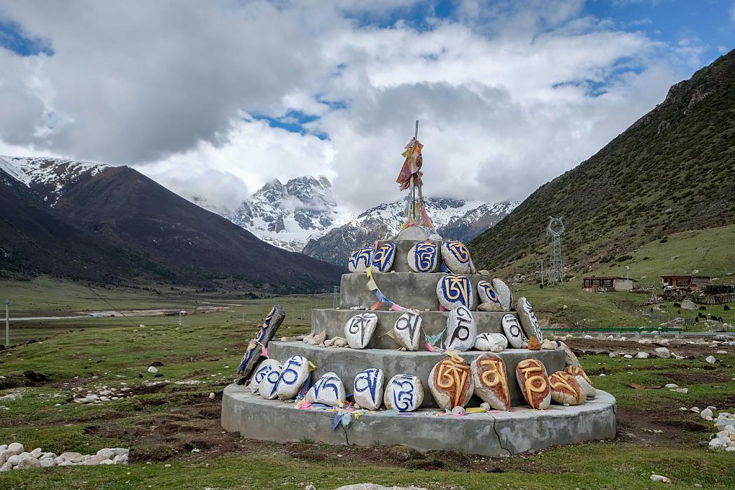
I drop off the edge of the Plateau and descend for hours through a green river valley strewn with weathered stupas and vast walls of mantra-covered mani stones, the hillsides fluttering with colourful fields of tattered prayer flags.
The Tibetan mode of religious decoration is essentially chaotic, the aesthetic all heaps and piles and tangles; by the roadside I actually see a man simply throwing coloured pieces of paper with deities printed on them into the wind. When it comes to sheer religiosity, the Bible Belt has nothing on Tibet.
Om mani padme hum
Come twilight I’m cycling through a steep-sided river gorge and there’s nowhere to camp. I do not want to be on these remote roads after dark, and my skin is beginning to crawl anxiously when moments later the gold roof of a small temple appears around a bend. When I approach the gates I’m greeted not by monks, but by a handful of 20-somethings who kindly invite me to spend the night on a plank bed in the kitchen.
As it turns out they’re stonecarvers. The walls of mani stones you see all over Tibet, piles of hundreds or thousands or sometimes millions of rocks, all carved in Tibetan script with the Buddhist mantra 'Om mani padme hum'.
It turns out it’s a bit of an industrial effort. Yeshi, wearing sunglasses even into the dusk to hide one blind, clouded eye, leads me around the yard of the compound showing me what they’ve been doing 8-10 hours a day for the last five months. He picks up an electric rotary stonecarving tool and then a football-sized rock with a mantra etched in it from a huge pile.
‘Om mani padme hum,’ he says, miming using the tool on the rock. ‘Yi mani, yi kwai,’ indicating that for every stone they etch, they earn the equivalent of about 10p. They’ve been here the entire long Tibetan winter and the yard is so full of carved stones it boggles the mind. And when they’re done in a month, they tell me after a dinner of vegetarian momos, they’re walking from here to Lhasa on pilgrimage.
No, wait, I have that wrong. I make a walking motion with my fingers and raise my eyebrows, and Lhamo corrects me. ‘Bu, bu, bu,’ she says, ‘No, no, no’. She makes a full prostration on the ground, then gets up, takes a step, and does it again. Holy hell. Lhasa is more than 1600km away. But everyone just grins like it’s no big deal, and I feel intensely humbled.
Gongga Shan
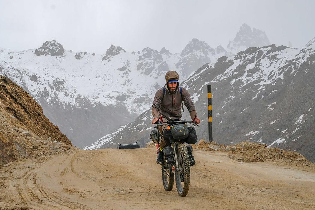
Morning and I’m riding again. Passing the looming Daxue Range and the sharp high white peak of 7556m Gongga Shan. On the third day my tyre fails as earlier foretold, and with a tyre boot sewn around the bead with dental floss, I begin the climb of the towering 4895m Cho La pass.
The road is rough dirt and I’m puffed, but the skies are a brilliant sapphire and after about four hours to the pass I’m feeling pretty good descending down the other side on my wonky tyre when out of nowhere it goes flat and the skies open up on me like the wrath of God.
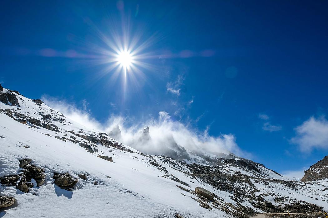
Being up here in a thundersnow storm, so high and exposed, fills me with an intense animal fear.
Five minutes later the patched-up tyre is flat again and even in my foul-weather gear I’m shivering badly. I get off the bike and start pushing as fast as I can, running downhill, trying desperately to generate some body heat and get below the storm. It’s still dumping 30 minutes later, but when a gently sloping stream valley suddenly appears beside the road like a sign of providence I know I’ll be all right. I set up my tent in the thudding snow, change out of my wet clothes and crawl into my sleeping bag, feeling an immense sense of relief.
Morning dawns with blue skies and I patch the three (three?!) holes in my tube while the sun cooks off the snow and dries my wet gear. A few hours later I cross the river at the village of Khorlomdo and turn north into the Si Chu Valley.
The nameless dirt track takes me upstream all day past tiny hamlets of crumbling mud-brick houses and through alpine meadows beneath high mountains, growing ever wilder and more empty and unpeopled.
I camp in a meadow beneath skies so dark that the Milky Way shines in a great luminous band like some kind of divine cosmic transmission, and the next morning turn northwest off the main track, all signs of habitation disappearing save for a single insane person in a tiny Suzuki Alto car crawling across uneven rockfall on 12-inch tyres. By this point the road is barely a road, disappearing into shallow river crossings a hundred metres wide and at several points narrowing into singletrack.
I hit habitation again late in the day, then turn west and set up camp in a steady rain that is still going the next morning when I pack up and start riding again. Whereupon I promptly get a flat. And then a second. And then a third.
The tyre is obviously cooked. I wait for a couple hours, hoping for a truck to pass by, but it’s the middle of nowhere and nothing does. So, hungry and muddy, I start pushing.
I push another five or six kilometres, thinking this is going to be a horrible, hungry night, when winding high up along the rim of the valley towards me comes a monk on a motorcycle.
Hours go by. I pass a few little houses. People smile, but don’t offer to help. It's 30km to the next real town and I'm out of fuel for my stove and I'm out of food and my inner narrative is now thoroughly pissed off. I push another five or six kilometres, thinking this is going to be a horrible, hungry night, when winding high up along the rim of the valley towards me comes a monk on a motorcycle.
He asks where I’m going, but I’m exhausted, so I just gesture down the road and keep walking. And amazingly the monk, who has no English, turns his bike around and motions for me to put my bicycle (which is bigger than his motorcycle) on the back. I tell him this is clearly impossible. But he insists, and so within a few minutes it's me, a monk and my laden touring bicycle on the back of a beat-up motorcycle tearing along this wild, remote mountain road.
The experience is uncomfortable and manifestly unsafe, but I have to admit as we pull into the town ninety minutes later that it’s also pretty incredible. The monk does a sort of victory lap around town, calling out to people, and you can tell that he is going to be dining out on this story for some time, which is understandable because let's be honest this guy is a complete legend. He drops me in town at the house of a family who stuff me full of yak momos and butter tea and give me a warm clean bed to sleep in.
Lying in bed that night falling asleep in the quiet darkness I have a moment of perspective.
Kham hasn’t been light entertainment. I’ve experienced hunger here and cold and exhaustion and actual mortal fear. And yet somehow each temporary hell I’ve wandered into has yielded, at its far side, some wonder much greater than the suffering that I endured to reach it: the landscapes, the moments alone in the high mountains, the nights beneath the sky.
And today: myself a stranger literally picked up off the side of the road, rescued and taken in again by people with no reason to help me, yet who help me just the same. I tear up a little.
Sometimes all the bad in the world seems to be redeemed by just a single instance of genuine human kindness; Kham has been incredible in so many ways, but in nothing more so than this. To hell with the news, I think, to hell with pessimism. The world is good and people are good.