Cycle network ‘tube map’ gallery

The Bath cycle network ‘tube map’ was the first of its kind
An illustration of a Tube map style map of the cycling network in Bath

Cycle network ‘tube map’ gallery

With the Cycling and Walking Investment Strategy published, including guidance on producing Local Cycling and Walking Infrastructure Plans (LCWIPs), local groups have been producing their own cycle network ‘tube maps’. Here we look at some brilliant examples

Bristol

An illustration of a Tube map style map of the cycling network in Bristol

Bath

An illustration of a Tube map style map of the cycling network in Bath

Derby

An illustration of a Tube map style map of the cycling network in Derby

Durham

An illustration of a Tube map style map of the cycling network in Durham

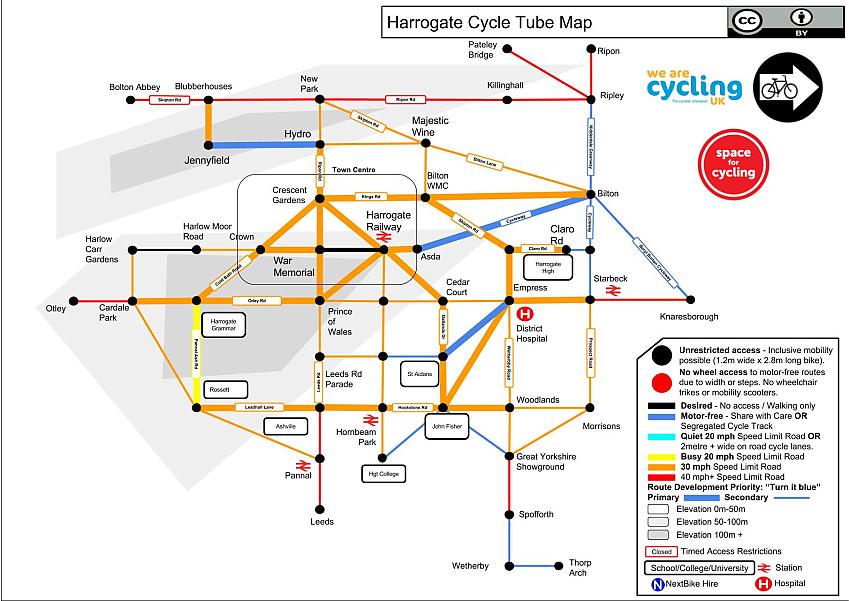
Harrogate

An illustration of a Tube map style map of the cycling network in Harrogate

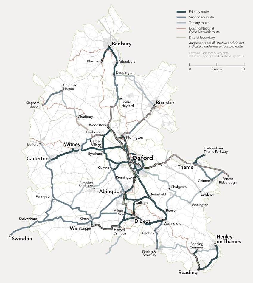
Oxfordshire

An illustration of a Tube map style map of the cycling network in Oxfordshire

Taunton

An illustration of a Tube map style map of the cycling network in Taunton

Want to make your own tube map? Check out our handy guide!

Sponsored Advert
Sponsored Advert
Sponsored Advert